'Unveiling the Tennessee Valley and Ridge: A Geological Wonderland' offers a comprehensive exploration of the captivating and intricate geological features that define this region. Encompassing areas of Alabama, Georgia, and Tennessee, the landscape is characterized by tightly folded and thrust-faulted rock layers, resulting in a visually striking interplay of ridges and valleys.
The geological narrative unfolds through a diverse range of Paleozoic sedimentary rocks, with Pennsylvanian sandstone dominating the ridges, while shale, limestone, and dolomite form the valleys. Additionally, the region's significance extends to its valuable natural resources, including iron-ore deposits in the Red Mountain Formation and extensive pecan orchards.
This article provides an immersive journey into the Tennessee Valley and Ridge, delving into its geological marvels, natural resources, and regional highlights.
Key Takeaways
- The Tennessee Valley and Ridge section is located in the southernmost part of the Valley and Ridge province of the Appalachian Highlands Region and extends into Georgia and Tennessee.
- It is characterized by tightly folded and thrust-faulted rock layers, with numerous uniquely zigzagging ridges separated by deep steep-sided valleys.
- The district is comprised of seven districts, each characterized by specific rock formations and topographic features.
- The Coosa River system, which drains about 5,350 square miles in Alabama, plays a significant role in the region, with several main tributaries joining the Coosa near Gadsden and seven dams producing a majority of Alabama's hydroelectric power.
Geological Formation and Landscape
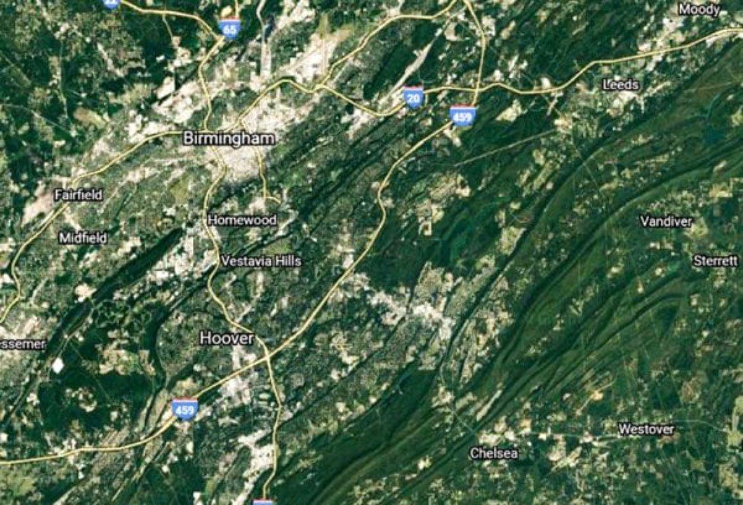
The Tennessee Valley and Ridge section is characterized by a tightly folded and thrust-faulted landscape, featuring numerous zigzagging ridges separated by steep-sided valleys, formed on Paleozoic sedimentary rocks. This geological history has resulted in a stunning and diverse topography, providing a wealth of outdoor recreation opportunities.
The region's unique rock formations, ranging from Cambrian to Pennsylvanian ages, offer a fascinating glimpse into the Earth's ancient past. Additionally, the rugged terrain and scenic beauty of the valleys and ridges make it an ideal destination for outdoor enthusiasts. Hiking, rock climbing, and birdwatching are just a few of the activities that draw visitors to this geological wonderland.
The Tennessee Valley and Ridge section not only offers a glimpse into the Earth's history but also provides endless opportunities for adventure and exploration amidst its striking landscape.
Districts and Topographic Features
Located within the Tennessee Valley and Ridge section are seven distinct districts, each characterized by specific rock formations and topographic features. These districts include:
- Birmingham-Big Canoe Valley, the westernmost district, stretching about 90 miles.
- Cahaba Ridge, Coosa Ridges, and Cahaba Valley, forming a complex of rugged ridges and deep valleys.
- Coosa Valley, the largest district, reaching up to 23 miles wide and 115 miles long.
Each district boasts unique geological formations and scenic beauty, offering a diverse landscape for exploration and appreciation. The geological formations in these districts contribute to the stunning topographic features, providing a glimpse into the intricate and fascinating history of the region's natural development.
This variety of districts within the Tennessee Valley and Ridge section showcases the rich and captivating geological wonders that contribute to the area's scenic beauty.
The Coosa River System
Flowing through the Tennessee Valley and Ridge section, the Coosa River System drains about 5,350 square miles in Alabama.
The river boasts a diverse range of wildlife, including various fish species like bass, catfish, and crappie, which attract anglers from across the region. Additionally, the Coosa River is home to a variety of bird species, such as herons, ospreys, and bald eagles, making it a popular destination for birdwatching enthusiasts. The river's ecosystem also supports a rich array of plant life, contributing to the overall biodiversity of the region.
Furthermore, the Coosa River is punctuated by several dams, including the Logan Martin Dam and the Weiss Dam, which not only regulate the flow of the river but also generate hydroelectric power, providing a sustainable energy source for the surrounding areas.
Natural Resources
Within the Tennessee Valley and Ridge section, the region's natural resources play a vital role in shaping its economic history and environmental significance.
- Hematite deposits: The Red Mountain Formation contains significant iron-ore deposits, particularly hematite, which has been integral to the iron and steel industry in the region.
- Coal mining: Abundant coal deposits in the Birmingham-Big Canoe Valley have contributed to the region's economic development and industrial growth.
- Limestone and dolomite: These abundant natural resources in the Birmingham-Big Canoe Valley have been essential for various industrial purposes, including construction and manufacturing.
The exploitation of these natural resources has played a crucial role in the economic development of the Tennessee Valley and Ridge, shaping its industrial landscape and contributing to its historical significance.
Red Mountain Formation
The geological significance of the Red Mountain Formation has contributed significantly to the understanding of the region's natural resources and industrial history.
The Red Mountain history dates back to the mining of iron-ore deposits, which played a crucial role in the iron and steel industry. The distinctive red color of Red Mountain is attributed to hematite, a red iron-oxide mineral found in the formation.
Mining of Red Mountain ore continued until the early 1970s, leaving a lasting impact on the industrial landscape of the region.
The Red Mountain geology not only provides insights into the geological history of the area but also stands as a testament to the intersection of natural resources and human industrial endeavors.
This formation remains a vital part of the region's geological and industrial heritage.
Randolph County
Located in the east central part of the state, Randolph County is known for its hills, lakes, rivers, and abundant wildlife opportunities.
The county offers a plethora of outdoor activities such as hiking, fishing, and bird watching, making it an ideal destination for nature enthusiasts.
Randolph County is committed to wildlife conservation, with numerous initiatives aimed at preserving the diverse ecosystem and protecting endangered species.
The area's natural beauty and ecological significance make it a prime location for fostering an appreciation of the environment and promoting sustainable practices.
With its picturesque landscapes and dedication to wildlife conservation, Randolph County stands as a testament to the harmonious coexistence of nature and human activity.
Pecan Production in Alabama
Randolph County, known for its abundant wildlife and natural beauty, also plays a significant role in the pecan production industry in Alabama. The state, one of the top 15 pecan-producing states in the U.S., boasts approximately 9,000 acres of pecan orchards across 30 counties, making it the leading pecan producer in the country. The pecan market in Alabama has shown promising trends, with a consistent increase in production and demand. Pecan orchards in Randolph County and other regions benefit from the optimal climate and fertile soil, contributing to the high-quality produce. The table below highlights the growth of pecan production in Alabama over the recent years:
| Year | Pecan Production (lbs) | Average Price per Pound ($) |
|---|---|---|
| 2017 | 3,500,000 | 2.50 |
| 2018 | 4,200,000 | 2.75 |
| 2019 | 5,000,000 | 3.00 |
Wright Brothers Flying School
Renowned for its geological wonders and agricultural richness, the Tennessee Valley and Ridge section is also historically significant as the location of the nation's first civilian flying school, the Wright Brothers Flying School, situated in Montgomery County. The Wright Brothers Flying School played a pivotal role in the history of aviation.
Importance of the Wright Brothers School
- Aviation History: The school holds significance as the nation's first civilian flying school, showcasing the pioneering efforts in aviation education.
- Innovative Training: It marked a turning point in the development of aviation training, laying the foundation for future flight schools and the growth of the aviation industry.
- Legacy: Despite its short-lived existence due to mechanical and weather-related challenges, the school's legacy continues to inspire advancements in aviation technology and education.
The Wright Brothers Flying School remains an enduring symbol of the relentless pursuit of human flight.
Branchheads and Physiographic Section
The Tennessee Valley and Ridge Physiographic Section is characterized by its unique valleys and ridges and is notable for its geological history and natural resources.
This section has a rich history and culture, with the term 'branchheads' being used to refer to working people, particularly poor farmers, and isolated or undeveloped areas in Alabama and North Carolina.
The region offers abundant opportunities for outdoor recreation, with its scenic beauty and diverse landscapes attracting hikers, nature enthusiasts, and adventure seekers.
The Tennessee Valley and Ridge Physiographic Section is an integral part of the broader geological wonderland, offering a glimpse into the historical significance and cultural heritage of the area, while also providing a playground for those seeking to immerse themselves in the great outdoors.
Frequently Asked Questions
What Are Some Popular Outdoor Recreational Activities in the Tennessee Valley and Ridge Section?
Outdoor enthusiasts can indulge in a plethora of activities in the Tennessee Valley and Ridge section, including outdoor rock climbing on the uniquely zigzagging ridges and exploring numerous hiking trails that showcase the region's geological wonders and scenic beauty.
How Has the Geological History of the Tennessee Valley and Ridge Section Influenced the Local Wildlife and Ecosystems?
The geological history of the Tennessee Valley and Ridge section has profoundly influenced local wildlife and ecosystems. Unique geological formations have impacted the adaptation of wildlife, shaping diverse ecosystems and contributing to the region's ecological richness.
What Are Some Unique Geological Features or Formations Found in the Tennessee Valley and Ridge Section?
The Tennessee Valley and Ridge section showcases unique rock formations, geological wonders, and natural beauty, providing opportunities for outdoor adventures. Its historical landmarks, hydroelectric development, and impact on local communities contribute to its significance.
Are There Any Significant Historical Events or Landmarks in the Tennessee Valley and Ridge Section?
The Tennessee Valley and Ridge section is marked by significant historical landmarks and cultural significance. Notable events include the establishment of the Wright Brothers Flying School and the Red Mountain iron-ore deposits' role in the iron and steel industry.
How Has the Development of Hydroelectric Power Along the Coosa River Impacted the Local Communities and Environment?
The development of hydroelectric power along the Coosa River has had a significant impact on local communities and the environment. Conservation efforts have been vital in mitigating environmental effects while fostering positive community relations through sustainable energy practices.
Conclusion
In conclusion, the Tennessee Valley and Ridge region offers a fascinating glimpse into the Earth's geological history and natural resources.
From the tightly folded rock layers to the iron-ore deposits and pecan orchards, the area is a testament to the forces of geological evolution and human ingenuity.
As we continue to explore and study this geological wonderland, we uncover the secrets of the Earth's ancient past and the potential for future discoveries.
Our Reader’s Queries
What is the ridge and valley region in Alabama?
This unique area is mostly made up of sandstone ridges and limestone or shale valleys that run from northeast to southwest. The Ridge and Valley ecoregion begins in Pennsylvania and stretches all the way to the Fall Line in Alabama.
What physiographic region is Alabama in?
Sapp and Emplaincourt identified five physiographic sections in Alabama. Three of these are part of the Appalachian Highlands Region, while one is in the Inland Plains and another in the Atlantic Plain Regions.
What are some of the physical characteristics of the Valley and Ridge region?
The prominent geographical characteristics of this region consist of expansive valleys cradled by slender ridges, or extended elevated land formations, which took shape as rivers slowly chiseled the landscape over countless millennia. Similar to the Appalachian Plateau, mining played a significant role in the Valley and Ridge’s economy.
What is the geology of the Tennessee Valley?
Closely spaced thrust faults have shaped the western edge of the valley, revealing shale on the surface. Meanwhile, the central and eastern areas of the valley were created on limestone and dolomite, mainly from the Knox Group.
Check Out For More References