'The Mighty Fall Line: A Natural Wonder Unveiled' meticulously explores the geological, historical, and ecological significance of the fall line, a boundary between the East Gulf Coastal Plain and the Appalachian Highlands Region.
With a focus on its impact in various regions, from Opelika to Montgomery and central to northwestern Alabama, this article delves into the fall line's role in early industrial development and the formation of colonial-era cities.
Through this exploration, readers gain a profound understanding of the fall line's geological composition, cultural importance, and support for diverse plant species, including the Cahaba lily.
This comprehensive unveiling aims to provide a scholarly perspective on the natural wonder of the fall line.
Key Takeaways
- The fall line is the boundary between the East Gulf Coastal Plain and the Appalachian Highlands Region.
- Waterfalls and rapids along the fall line provided power for water wheels and flumes.
- Early colonial-era cities developed along the fall line.
- The fall line is home to several plant species, including the Cahaba lily.
Definition and Significance of the Fall Line
The fall line, a geologic and geographic boundary, holds significant historical and ecological importance in the United States. Its significance lies in its role as a boundary between different geological regions, impacting the landscape, waterways, and human settlement patterns.
The fall line's geological features, such as waterfalls and rapids, have historically provided power for industrial and agricultural activities, shaping the development of early colonial-era cities. Moreover, the ecological importance of the fall line is underscored by its unique flora and fauna, including plant species like the Cahaba lily.
As a result, the fall line has not only influenced the historical and economic development of the United States but has also contributed to the preservation of distinct ecological habitats, making it a site of both historical and ecological significance.
Historical Development Along the Fall Line
Historical development along the fall line is marked by the establishment of early colonial-era cities and the utilization of waterfalls and rapids for industrial and agricultural activities.
The economic impact of these developments was substantial, as the availability of water power facilitated the growth of industries such as mills, factories, and textile production. This led to the rise of urban centers and trade hubs, contributing to the region's economic prosperity.
Furthermore, the cultural significance of these historical developments is evident in the preservation of architectural landmarks, traditions, and the establishment of vibrant communities that continue to thrive along the fall line.
The legacy of these early developments continues to shape the cultural and economic landscape of the region, serving as a testament to the enduring impact of historical development along the fall line.
Fall Line in Alabama: Opelika to Montgomery
Development along the fall line from Opelika to Montgomery in Alabama is characterized by a visible change in slope, wherein the Piedmont rocks underlie a plateau higher than the Coastal Plain rocks. This geographical feature has had a significant impact on the local economy, particularly through the utilization of water power from local falls, leading to the development of small towns like Griffin Mill and Whatley Mill. Moreover, the fall line attractions in this area have contributed to tourism and recreational activities, further boosting the economy.
| Fall Line Attractions | Impact on Local Economy |
|---|---|
| Waterfalls and Rapids | Utilization of water power for economic development |
| Small Town Development | Economic growth through local industries |
| Tourism and Recreation | Boosting local economy through visitor spending |
This unique geological feature has not only shaped the landscape but also played a pivotal role in driving economic activities and enhancing the overall appeal of the region.
Interstate 85 and the Fall Line
Running through the Coastal Plain and roughly paralleling the fall line, Interstate 85 serves as a crucial transportation artery in the region.
Impact of Interstate Development:
- Economic Growth: Interstate 85 has facilitated economic development by connecting cities and towns along the fall line, leading to increased trade and commerce.
- Job Creation: The construction and maintenance of Interstate 85 have generated employment opportunities, contributing to local and regional economies.
- Infrastructure Enhancement: The interstate's presence has spurred the development of supporting infrastructure, such as logistics centers, warehouses, and industrial parks.
- Tourism Boost: Improved accessibility has attracted tourists to explore the natural wonders along the fall line, benefiting the local tourism industry.
The Economic Benefits of the Fall Line have been significantly amplified by the strategic presence of Interstate 85, fostering growth and prosperity in the region.
Industrial Development in Fall Line Towns
Exploring the industrial development of Fall Line towns reveals significant economic growth and infrastructure enhancements. The impact of industrialization in these areas has been profound, fostering economic prosperity and technological advancements.
The utilization of water power from the falls along the fall line has facilitated the establishment of numerous industrial centers in small towns, leading to job creation and economic diversification. As a result, these towns have experienced a surge in population and a boost in trade and commerce.
The industrial development has not only improved the standard of living for residents but also enhanced the overall infrastructure, including transportation networks and public facilities. Consequently, the Fall Line towns have emerged as vital contributors to the regional economy, playing a pivotal role in the economic growth and development of the surrounding areas.
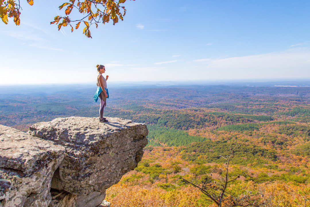
Geographical Features of the Central Alabama Fall Line
Nestled within the heart of central Alabama, the fall line showcases distinctive geographical features that underscore the region's natural diversity and topographical complexity.
- Geological Formation: The central Alabama fall line is characterized by narrow, steep-sided valleys and flat higher areas, formed by the erosion of rocks by the Coosa River, resulting in a zone about five miles wide.
- Natural Beauty: The valleys in the Valley and Ridge section are underlain by easily eroded shale, limestone, and dolomite, while the higher elevations are underlain by rocks of the Coastal Plain. The resistant Pottsville sandstone forms ridges, creating a picturesque contrast with the Coastal Plain rocks in the valleys.
- Topographical Complexity: This area features a unique blend of geological formations, including resistant sandstones of the Cumberland Plateau meeting the Coastal Plain, resulting in a slope with an elevation change of about 120 feet.
- Environmental Diversity: The region's topographical intricacies provide a habitat for diverse plant species, further enhancing the area's natural allure.
Geological Composition of the Fall Line
The geological composition of the fall line is characterized by a diverse array of rock formations, including resistant sandstones, easily eroded shale, limestone, and dolomite, creating a unique topographical tapestry.
The formation process of the fall line began millions of years ago, as powerful geological forces uplifted and folded ancient rocks, resulting in the creation of the resistant sandstone formations and easily eroded shale and limestone layers.
These geological features have played a crucial role in shaping the landscape and hydrology of the fall line region.
Moreover, the ecological significance of these rock formations is evident in the diverse habitats they support, contributing to the rich biodiversity found along the fall line.
The interplay of these geological formations has not only shaped the physical landscape but also influenced the distribution and abundance of plant and animal species in this region.
Northwestern Alabama Fall Line
Northwestern Alabama hosts a distinct fall line characterized by a gentle slope and an elevation change of about 120 feet, marking the junction where the Coastal Plain meets the resistant sandstones of the Cumberland Plateau. This geological feature carries significant implications for the region's landscape and natural heritage.
Geological Formation:
- The fall line in this region is formed by the convergence of the Coastal Plain and the Cumberland Plateau's resistant sandstones.
- It represents a transition zone between different geological terrains, shaping the area's topography and hydrology.
Cultural Impact:
- The fall line has historically influenced settlement patterns and economic activities due to its potential for water power from local falls.
- It has played a role in the development of small towns and industries utilizing water resources in the area.
The distinctive geological formation of the fall line in Northwestern Alabama has not only shaped the region's natural landscape but also influenced its cultural and economic development.
Resources for Further Exploration
A comprehensive list of external links and related articles provides valuable resources for further exploration of the fall line's geological and cultural significance.
Potential discussion ideas include the environmental impact of development along the fall line and conservation efforts to protect the unique species in the fall line region.
The 'Discovering Alabama: Rivers Systems' link offers insights into the environmental impact of development along the fall line, while the 'New Georgia Encyclopedia' provides in-depth information on conservation efforts.
Additionally, the article 'Blount County: Known for its natural beauty and outdoor attractions' sheds light on conservation initiatives in the fall line region.
For a deeper understanding of the cultural significance, the 'William Christenberry: Alabama-born artist known for his diverse works' article delves into the artistic representation of the fall line's significance.
Moreover, the 'Territorial Period and Early Statehood: Alabama's history of migration and expansion' link provides historical context for the cultural impact of the fall line.
Frequently Asked Questions
What Are the Economic Impacts of the Fall Line on the Surrounding Communities?
The fall line's economic impacts on surrounding communities are significant. It fosters tourism and development, creating job opportunities and driving infrastructure growth. The historical significance and natural beauty of the fall line attract visitors, stimulating economic activity.
How Have Human Activities Affected the Natural Environment Along the Fall Line?
Human development and urbanization along the fall line have led to industrial pollution and deforestation, impacting the natural environment. Increased urban expansion has disrupted ecosystems and harmed the biodiversity of this ecologically significant area.
What Are Some Unique Cultural or Historical Aspects Associated With the Fall Line in Alabama?
The fall line in Alabama is a rich tapestry of cultural heritage and historical significance. Its unique location has shaped early colonial-era cities, provided power for industrial development, and inspired the growth of diverse plant species, reflecting a deep connection to the state's history.
How Does the Fall Line Impact Water Resources and Ecosystems in the Region?
The fall line impacts water resources and ecosystems in Alabama by influencing the distribution of agricultural activities and preserving biodiversity. Its geological features shape water flow and create diverse habitats crucial for sustaining local flora and fauna.
Are There Any Conservation Efforts in Place to Protect the Fall Line and Its Surrounding Areas?
Conservation efforts are underway to protect the fall line and its surrounding areas, focusing on environmental protection, wildlife preservation, and natural habitat. These initiatives aim to safeguard the unique ecological and geological features of the region.
Conclusion
In conclusion, the fall line stands as a testament to the intersection of geological and cultural significance, shaping the development of towns and cities along its path.
Its historical importance and ecological diversity highlight the impact of this natural wonder.
As we delve deeper into the characteristics and impact of the fall line, we uncover a tapestry of human and natural history woven into the fabric of the land, like a jewel in the crown of Alabama's landscape.
Our Reader’s Queries
Is there a fall line in Alabama?
In Alabama, the fall line isn’t always a steep drop. As you travel from Opelika to Montgomery, you’ll notice a shift in slope where the sturdy Piedmont rocks meet the sand and gravel of the Coastal Plain. The change is clear, with the Piedmont rocks supporting a plateau that sits 150 to 200 feet above the Coastal Plain rocks.
What is the fall line known for?
The eastern United States is home to a significant fall line, separating the tough Appalachian Piedmont rock from the gentle sediment of the Atlantic Coastal Plain. Early European explorers found this line crucial as it signaled the end of river travel for their ships.
Why is the divide called the fall line?
The fall line, also known as the fall zone, is where an elevated area meets a coastal plain, often creating rapids or waterfalls where rivers flow across it. The uplands consist of tough, crystalline basement rock, while the coastal plain is made up of softer sedimentary rock.
Why is it called the fall line?
Rivers running on the fall line form waterfalls and rapids, hence the name “fall line”. The geological areas north of this line comprise the Appalachian Plateau, the Valley and Ridge, the Blue Ridge, and the Piedmont.
Check Out For More References