Strong Storms Possible Tomorrow: As meteorologists closely monitor the weather patterns, tomorrow’s forecast has raised concerns about the potential for strong storms in the region.
The weather outlook, while not definitive, has sparked interest among residents and professionals alike.
With the possibility of severe weather looming, it is crucial to stay informed and prepared.
In this discussion, we will explore the factors contributing to this weather outlook, analyze the potential impacts, and provide valuable insights to help you navigate the upcoming conditions.
Key Takeaways
- Tomorrow’s weather outlook includes the potential for strong storms due to an approaching cold front and upper trough.
- The Storm Prediction Center has outlined a ‘slight risk’ of severe thunderstorms, with the primary threat being strong winds and isolated tornadoes also possible.
- Residents in Alabama should expect rainfall of 1-2 inches, with a flood watch in effect for central counties. Cities like Birmingham, Montgomery, Mobile, and Huntsville are expected to receive significant rainfall.
- Following the storms, Sunday’s weather will be notably cooler and mostly cloudy, with temperatures in the 40s in northern parts of the state and highs in the 50s in South Alabama.
Current Weather Snapshot for Alabama
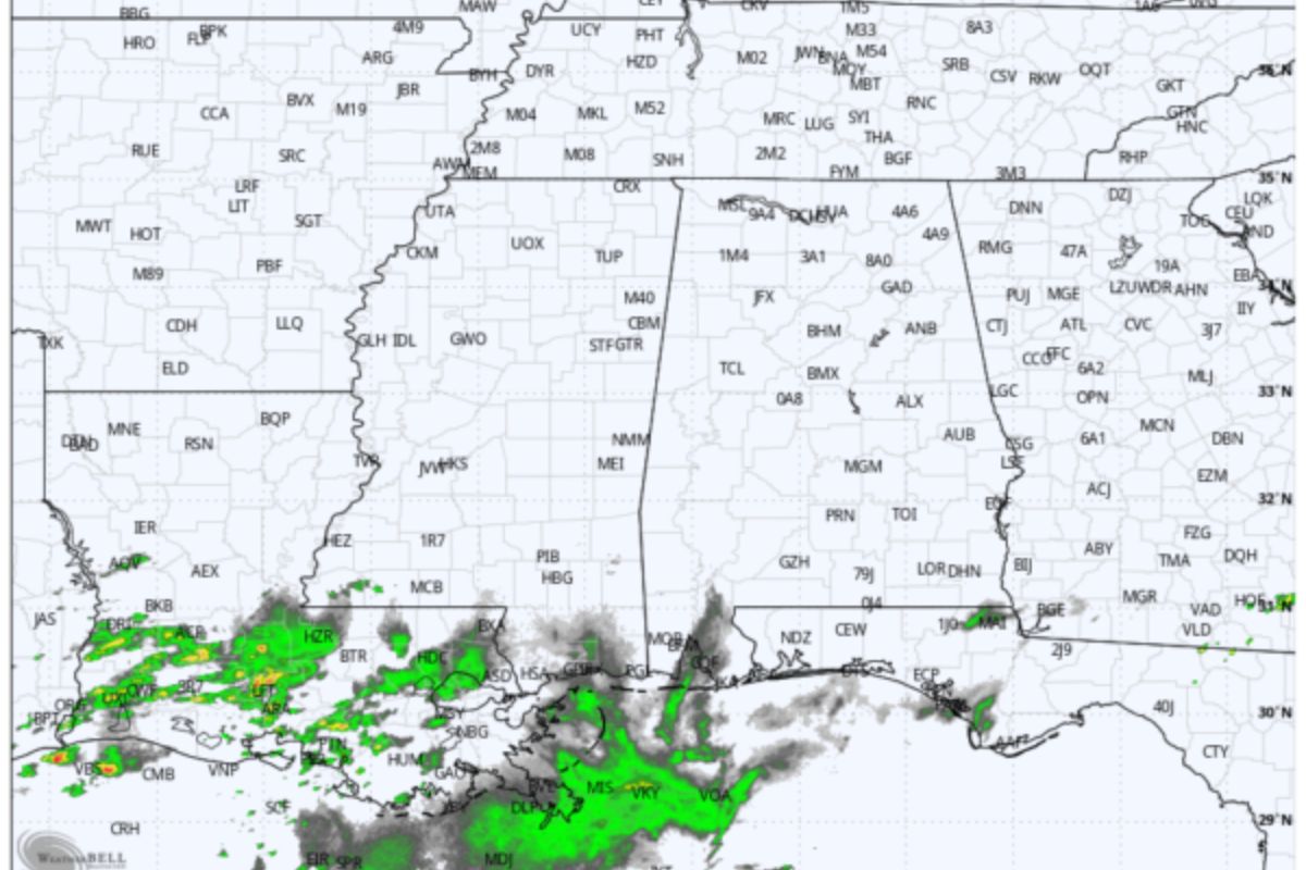
The current weather in Alabama presents a mostly cloudy afternoon with dry conditions and temperatures ranging from the upper 60s to low 70s. Despite the absence of rain, an approaching upper trough signals potential changes in the weather pattern later tonight.
As we examine the current weather snapshot for Alabama, it is important to note the cloud cover that is dominating the sky, shielding the state from direct sunlight. This cloud cover contributes to the cooler temperatures observed, with highs reaching only the upper 60s to low 70s. Furthermore, the absence of precipitation provides a dry environment, suitable for outdoor activities.
However, the looming upper trough brings the possibility of rain. It is crucial to stay informed and prepared for any potential changes in weather conditions in the coming hours.
ALSO READ: First Alert Weather Day Announced for Wednesday Risk of Flooding
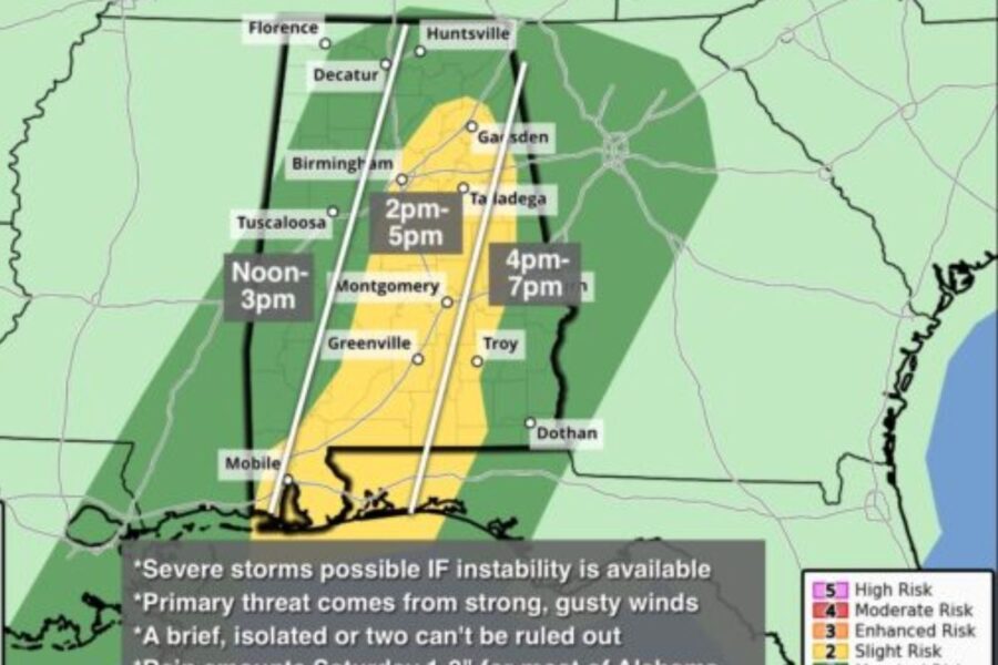
Severe Weather Outlook: Two Rounds of Rain and Storms Tomorrow
An approaching cold front and upper trough will bring two rounds of rain and storms to Alabama tomorrow, posing potential risks of severe weather. The Storm Prediction Center (SPC) has outlined a ‘slight risk’ of severe thunderstorms in certain areas, with a ‘marginal risk’ covering the rest of the state. The primary threat is strong winds, with isolated tornadoes also possible. The timing of the storms is expected from noon to 7:00 p.m., maintaining mild temperatures.
As the cold front and upper trough move through the state, here are three key things to expect:
- Intense rain showers that may lead to localized flooding.
- Thunderstorms with strong gusty winds, capable of causing damage to structures.
- Isolated tornadoes that have the potential for brief but significant damage.
Stay alert and prepared for changing weather conditions tomorrow, and follow any guidance or warnings issued by local authorities to ensure your safety.
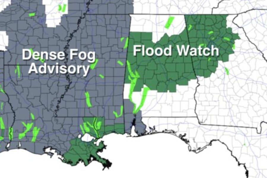
Rainfall Expectations and Flood Watch
As the weather system continues to move through Alabama, there are significant concerns regarding rainfall expectations and a flood watch in many central counties. The projected rainfall associated with this weather system ranges from 1-2 inches across Alabama by tomorrow evening. A flood watch is in effect for these central counties, indicating the potential for significant precipitation and the need for heightened awareness of flooding risks.
To provide a clearer picture of the rainfall expectations, the following table presents the projected rainfall amounts for selected cities in Alabama:
| City | Rainfall Expectations |
|---|---|
| Birmingham | 1.5 inches |
| Montgomery | 1.2 inches |
| Mobile | 1.8 inches |
| Huntsville | 1.1 inches |
It is important for residents in these areas to stay informed about weather updates and be prepared for potential flooding.
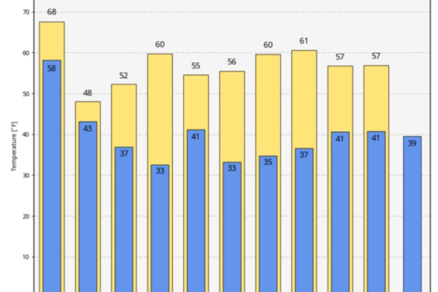
Cooler and Cloudy Sunday with Historical Weather Context
Sunday’s weather will be mostly cloudy and notably cooler, with temperatures in the 40s expected in northern parts of the state and highs in the 50s in South Alabama. As we prepare for this change in weather, let’s take a moment to appreciate the historical weather context of this date.
In 1772, Washington DC experienced a significant snowfall, blanketing the city in a beautiful white coat. Meanwhile, in 1940, Alabama faced a deep freeze, with temperatures dropping to record lows. These historical events serve as a reminder of the unpredictability of weather and the importance of staying prepared.
Extended Forecast and Historical Weather Highlights
Looking ahead to the extended forecast and reflecting on historical weather highlights, we can expect dry conditions for the upcoming week, with the possibility of scattered light rain on Tuesday night or Wednesday morning in North Alabama. High temperatures will range from the 50s to the 60s, while lows will mostly be in the 30s.
This forecast suggests a relatively calm weather pattern with no major disturbances expected.
It is important to note that historical weather data reveals the variability and significance of weather events on this date in the region. These historical highlights serve as a reminder of how weather patterns can vary and impact our daily lives.
As we continue to monitor the forecast, it is always beneficial to consider the historical context for a comprehensive understanding of weather patterns.
Conclusion Of Strong Storms Possible Tomorrow
Tomorrow’s weather outlook for Alabama indicates the possibility of strong storms and heavy rainfall. This could lead to potential flooding, as indicated by the flood watch.
Sunday is expected to be cooler and cloudy, with historical weather context suggesting similar patterns in the past.
Looking ahead, the extended forecast indicates continued unsettled weather conditions.
Our Reader’s Queries
How do I turn on weather alerts?
Activate Weather alerts on your Android 12 device by swiping up from the bottom of the home screen to open the app drawer. Find the Weather app and long-press the icon. Then, tap the App info button from the options that appear. Next, go to Notifications and simply slide the Weather alert button to the on position to enable weather alerts.
Can Google home give weather alerts?
Easily check the weather and upcoming forecast for your area using just your voice with a Google Nest or Home speaker or display.
How do I turn on weather alerts on Android?
Navigate to the “Settings” app on your Android device. Tap on “Notifications” and then select “Advanced Settings.” From there, choose “Wireless emergency alerts” and switch on the “Allow Alerts” option. Make sure to turn on all the alert options listed below to ensure you receive important notifications.
What is the weather alert app for Android?
The Storm Shield app delivers severe weather alerts to users based on their exact location. It uses voice alerts, like a NOAA weather radio, through push notifications. The app also provides access to radar maps, current conditions, and hourly and daily forecasts. It includes nationwide radar, NWS forecasts, and severe weather alerts to keep you informed and safe.