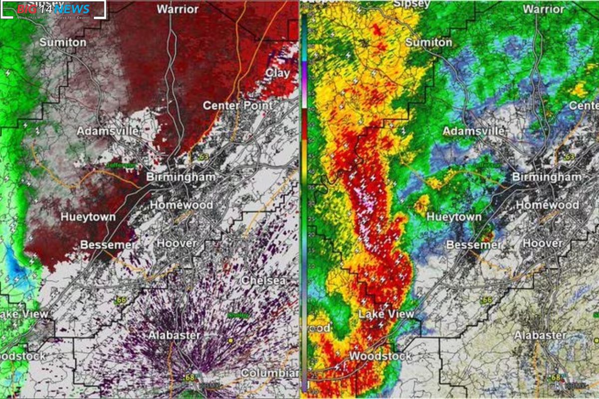
Weather Service Confirms Two Tornadoes: Overnight in Birmingham, it seems not one, but two tornadoes decided to make their presence known. The National Weather Service in Birmingham did their detective work and confirmed two mini tornado tracks, slapping them with preliminary EF-1 ratings for the destruction they left in their wake.
Details are still in the oven, but the weather service spilled the beans that the first tornado track set up camp north of Lakeshore Parkway. It played hopscotch from near the Wildwood shopping center to Samford University, with winds showing off at around 100 mph.
Now, the second track took a stroll from near Brookwood Mall to Mountain Brook and Cahaba Heights. Winds in that neck of the woods danced around 90 mph.
To add a sprinkle of drama, the weather service radar did a little tap dance, hinting at possible tornadoes in Lee and Barbour counties on the east side of the state. Monday was set to be the day for storm surveys in those areas.
In the wee hours, southeast Alabama’s Dale and Henry counties had their share of tornado warnings, courtesy of the NWS in Tallahassee, Fla.
The silver lining, at least for now, is that there are no reports of injuries from these stormy shenanigans. Jason Holmes, the Meteorologist at the National Weather Service, gave us a sneak peek into the tornado’s playground, starting in Bessemer in the western part of Jefferson County.
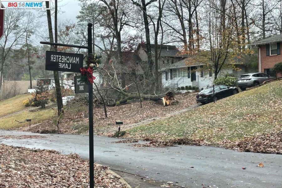
Most of the Jefferson County damage seemed to be between Bessemer and Hoover, where a storm played its own version of hopscotch. It pirouetted northeastward from Bessemer to the Bluff Park area, waltzing through portions of Hoover, Vestavia Hills, Homewood, and then making its grand exit toward Mountain Brook and eventually reaching (U.S.) 280.
Hold onto your hatsno, literallythere was a wind gust of 58 mph at the Birmingham (International) Airport, hitting that severe criteria sweet spot.
ALSO READ: Alabama Braces for Weekend Storms: Strong Winds, Possible Tornadoes in the Forecast
The storm kept up its journey northeast, leaving its mark on east Jefferson County and then St. Clair County. As of Sunday morning, the weather service hadn’t received any damage reports from areas like Trussville, Argo, Margaret, and Pell City.
Holmes gave the public a bat signal, urging them to send in reports of any damage from the region. Whether it’s a message on social media or a call to their county emergency manager, every bit helps.
Why? Because, folks, it’s not just about making the weather service’s day. It’s also about helping out those filing insurance claims. When people go to bat for their insurance claims, one of the first things they do is consult the storm report documents. So, letting the weather service know about the damage helps make it official and recorded for posterity.
As bad as the damage might look, Holmes is throwing a lifelineit could have been worse. Tennessee took a beating, and conditions were ripe for some serious tornado action down here. So, while we did get some wild weather, it’s a silver lining in the storm clouds.
The weather service is gearing up to spill the beans on storm surveys as soon as the info is hot off the press. Keep an eye out for more updates because, hey, it’s all about staying weather-wise and community-strong.